Pune District is the center of educational and cultural activities and a socurce of inspiration for progress and development in all spheres of life. It is the second-largest town in the State. The literacy percentage in the district is high compared to that of the State. The district is well connected by rail and road to all important cities. The district has a major Defence and Research establishment. Agriculture occupies a major share in the economic activities in the district, followed by industries and service sectors. The IT industry is developing very fast in and around city. A unique Information-tech park is established for the development of the IT industry. Surrounded with hills and lakes, the picturesque city of Pune is the pride of west India. It is the cultural capital of the state of Maharashtra.The cultural and intellectual capacity of Pune has earned it the title of being the ‘Oxford of the East’. Pune is 192 km from Mumbai & situated on Mumbai Banglore National Highway (NH-4).
Pune district has 14 Talukas viz. Pune, Haveli, Khed, Ambegon, Junnar, Shirur, Daund, Indapur, Baramati, Purandar, Bhor, Velhe, Mulshi and Maval. The collector is the Administrative Chief at the district level, and at the tehsil level, tehsildars are looking after the administration as per Collector's instructions. For rural development, the Chief Executive officer of the Zilla Parishad and Block Development Officers oversee the administration at the block level. Muncipal Councils are responsible for the urban development of all the tehsils. There are 13 Panchayat Samities, 11 nagar Parishads, and 2 Muncipal Corporations.
The district lies between 17.5° to 19.2° North latitudes and 73.2° to 75.1° East longitudes. The district is surrounded by Ahmednagar district on the North and East, Satara district on the South, Raigad district on the West, Solapur district on the South-East, and Thane on the North-West. The district has geographical area of 15,642 sq.km. Pune district is surrounded by Ahmednagar district on North-East, Solapur district on the South-East, Satara district on south, Raigad district on the west and Thane district on the North-West. It is the second largest district in the state and covers 5.10 % of the total geographical area of the state. The landscape of Pune district is distributed triangularly in western Maharashtra at the foothills of the Sahyadri Mountains and is divided into three parts: "Ghatmatha", "Maval" and "Desh". Pune district forms a part of the tropical monsoon land and therefore shows a significant seasonal variation in temperature as well as rainfall conditions.Climate of the western region of Pune is cool whereas the eastern part is hot and dry.
The district is well connected with the state capital and surrounding district headquarters through road and rail linkages. The road network consists of Express Highways, National Highways, State highways, and Major District Roads. The rail network consists of broad gauge (Electrified and Non-Electrified) double-track and single-track lines. The district airport connectivity is used to transport and trade to major airports within the country and select international destinantions. Despite the availibility of perennial river stretches, there is no significant utilization of the waterways in the district.
The total railway network of Pune has both broad gauges single and double track rail lengths within the district with a total distance of 311 km. The single line is 162 km, and the double line is 149 km. Pune and Daund are the two railway junctions in the district. Following are the three railway routes passing through the district: Mumbai-Pune-Solapur rail route Daund-Baramati rail district.
Pune is well connected through domestic airlines with entire country. The airport located at lohegaon has recently acquired the status of an international airport and is being used to carry domestic and international traffic. Also, it is proposed to develop a global air-cargo hub near Khed Tahsil of the district.
Industrial areas in Pune District are as mentioned below
| Name of the Industrial Area | Allocates Area [in Hectars] | Total Plots | Plots Distributed |
|---|---|---|---|
| Rajiv Gandhi Infotech Park | 96.42 | 57.95 | 57.95 |
| Indapur Industrial Area | 286 | 221.56 | 213.49 |
|
Kharadi Knowledge Park |
30 | 25.54 | 23.75 |
| Rajiv Gandhi Infotech park PH2 | 236.23 | 163.05 | 163.05 |
| Pimpri | 1,224.0 | 1,1818 | 1,799 |
| Chakan | 961.98 | 183 | 183 |
| Talegaon | 577.81 | 28 | 27 |
| Ranjangaon | 924.00 | 435 | 324 |
| Jejuri | 144.53 | 249 | 207 |
| Baramati | 752.48 | 750 | 735 |
| Bhigwan | 379.94 | 8 | 4 |
| Pandhare | 28.29 | 51 | 49 |
| Kurkumbh | 473.22 | 169 | 149 |
Pune district is divided into four agro-climatic zones. The coverage regarding the type of soil and crops grown in respective zones are also described below
The area included in this zone comprises the hilly, high lying terrains round about the Ghats of Lonavala and Khandala in the Pune District. Cultivation of hill millets like nagil wari is grown, and on some land paddy is grown.
The Western portion of Junnar forms this, Western half Ambegaon, Khed, Bhoe and Western and central portion of Maval, Mulshi and Velhe Tahsils. The area is extremely rugged.
The zone comprises the mid-western part of Junnar, Khed, the eastern hald of Ambegaon and Eastern strips of Velhe, Mulshi, Bhor and the western portion of Haveli Tahsil.
This zone covers the eastern corner of Junnar, Southeastern portion of Khed, the Eastern hald of Haveli, and the entire portion of Shirur, Purandar, Daund, Baramati, Indapur Tahsils. The soils are brown to black calcareous soils with varying depth and textures.
Due to the geographical conditions of the district, the rainfall is unevenly distributed. The Western part of the district adjacent to the West coast is hilly area having forest cover, due to which the rainfall intensity is more in this area as compared to the eastern parts.
Most of this rain is brought by the southwest monsoon winds during the summer and about 87% of rainfalls during the monsoon months.The monsoon arrives in the month of June, with the maximum intensity of rainfall during the month of July and August. Talukas falling in the highest rainfall intensity zone are Velha, Mulshi and Maval.
Talukas falling in the moderate rainfall intensity zone are Bhor, Ambegaon, Junnar, Khed, Haveli, Pune city and Purandar. Talukas with lowest rainfall intensity, the dry and semi-arid zone are Shirur, Daund, Indapur and Baramati.
April and May are the hottest months in the district. Maximum temperature during these months often rises above 36 degrees C. The western region of Pune district i.e. Talukas as : Junnar, Ambegaon, Khed, Maval, Mulshi and Velha are cool whereas the eastern part i.e. Talukas as : Shirur, Daund, Baramati and Indapur are hot and dry. December and January are the coolest months, when average temperature falls as low as 11 degrees C.
Humidity is low during the summer months due to increased evaporation losses from the atmosphere. The diurnal variations in humidity during this period are high, water vapor gets condensed due to falling nighttime temperatures and the daytime temperatures are high.
Natural hazards threaten sustainable economic development worldwide. Natural hazards like earthquakes, floods, tropical storms, droughts and other calamities may result in loss of life and property worth millions of rupees. Disasters destroy decades of human efforts and investments, thereby placing new demands on society for reconstruction and rehabilitation.
Earthquakes and floods have affected Pune district in the past.The details of the areas which are susceptible to natural hazards have to be avoided for siting of industries.
Due to the presence of many structured hills within Pune district, occurrences of earthquakes take place. Fault lines are scattered throughout the district and these areas are minor earthquake prone areas. Small south-west side portion of taluka Bhor and Velha fall under risk zone-IV, which is high damage risk zone. The remaining part of the district falls under the zone III, which is moderate damage risk zone.
Most of the talukas in Pune district are flood prone. The rivers likely to cause flooding are river Bhima (Tal. Shirur, Daund, Indapur and Haveli), River Mula (Pune-city), river Mutha(Tal.Punecity and Mulshi), River Indrayani (Tal. Khed, Haveli and Maval), River Ghod (Tal. Ambegaon), River Mina and Pushpavati (tal Junnar), River Nira (Tal. Indapur and Purandar), River Pavana(Tal. Haveli).
| Sr.No. | Particulars | Total Number |
|---|---|---|
| 1 | Blocks | 14 |
| 2 | Block Committees (Panchayat Sammittes) | 13 |
| 3 | Urban areas – out of Corporation Cantonment Municipal Corporation Census Towns |
25 2 3 11 9 |
| 4 | Number of villages | 1866 |
| 5 | Number of Grampanchayat | 1401 |
| 6 | Population (Census 2001)- Out of Male Female per 1000 male Female Rural area Urban area |
72.33 lacs 37.69 lacs 34.64 lacs 919 42% 58% |
| 7 | Literacy percentage | 80 |
| 8 | No.of Agriculture producing Marketing Committee | 11 |
| 9 | Irrigation facility available to Total land under cultivation | 23% |
| 10 | Veterinary hospitals | 68 |
| 11 | Veterinary aid centers | 210 |
| 12 | Rural Households | 920536 |
| 13 | BPL Households | 122000 |
| Classification of holding | Holding | Area | ||
|---|---|---|---|---|
| Nos. | % to total | Ha. | % to total | |
| Upto 1 hector | 193970 | 39 | 722321 | 9 |
| Between 1 to 2 hector | 124316 | 25 | 1364383 | 17 |
| Above 2 hector | 180536 | 36 | 5939080 | 74 |
| Total | 498822 | 100 | 8025784 | 100 |
| S.No | Agency | No.of Banks/Soc. | No.of Branches | ||
|---|---|---|---|---|---|
| Total | Rural | Urban | |||
| 1 | Commercial Bks | 62 | 638 | 219 | 419 |
| 2 | Regional Rural Banks | 2 | 2 | 2 | - |
| 3 | District Central Cooperative bank | 1 | 283 | 243 | 40 |
| 4 | Coop. Agril. & Rural Dev.Bank | 1 | 24 | 23 | 1 |
| 5 | Primary Agril. Coop.Soc. | - | 1248 | 1248 | - |
| 6 | Other | - | 90 | - | 90 |
| 66 | 2248 | 1699 | 549 | ||
As per District Industries profile 2012-13, There are 2647 service enterprises (micro - 1856, small - 773 and medium - 18) providing and employment of 18886. Some of the major services which are providied in the district are as listed below :
Pune is also a prime tourist destination of the state.The city has historical monuments, museums and more famous are its hill stations.Tourists from all over the world visit the city to share rare moments filled with anxiety and curiosity.
Immediate Payment Service is an interbank electronic instant mobile money transfer service through mobile phones. Our IMPS service helps you access your Bank Account and transfer funds instantly. The beneficiary account is credited immediately when a Fund Transfer request is made through your Mobile phone is an interbank electronic instant mobile money transfer service through mobile phones. Our IMPS service helps you access your Bank Account and transfer funds instantly. The beneficiary account is credited immediately when a Fund Transfer request is made through your Mobile phone ccount and transfer funds instantly.
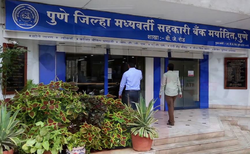
| Number Of Branches | 17 |
| Number Of ATM | 17 |
| Branch Name | Branch Code | Branch Address | Current Location | Contact Number |
|---|

| ATM Name | ATM Address |
|---|
So instead of keeping that gold jewellery, coins, bars or biscuits lying ideal in your locker, you surely could use them to meet those cash contingencies.